
What the heck is in the woods behind ‘Grad’? An architectural mystery, solved
Crumbling bricks and cement. Giant slabs of rock. What looks like the top of an enormous concrete pot. An investigation into the ruins in the forest reveals a historical relic in our own backyard.
While looking at a map will tell you that the wooded area just beyond the southeast edge of campus is Fox Park, most Brandeis students probably know it as simply the woods by “Grad,” the colloquial name for Charles River Apartment student residences. The woods — a two-minute walk from “Grad” and a twenty-minute walk from central campus — contain about a half-mile worth of public trails. With swampy inlets surrounding the forest on one side and campus housing on the other, the forest is mostly contained to a small strip of land that extends out from Mt. Feake cemetery.
The woods are small, but the mysteries within them are anything but. Jake Nissen ’23, a student living in “Grad,” reported hearing a strange sound coming from beyond the treeline while waiting for the BranVan one late January evening. “There was a weird sizzling and a mechanical noise that kept going for like fifteen minutes,” Nissen told the Justice on March 7. “I felt unsettled and confused.”
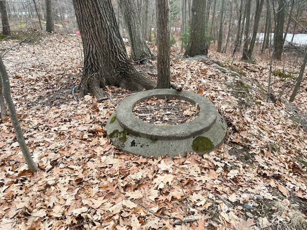
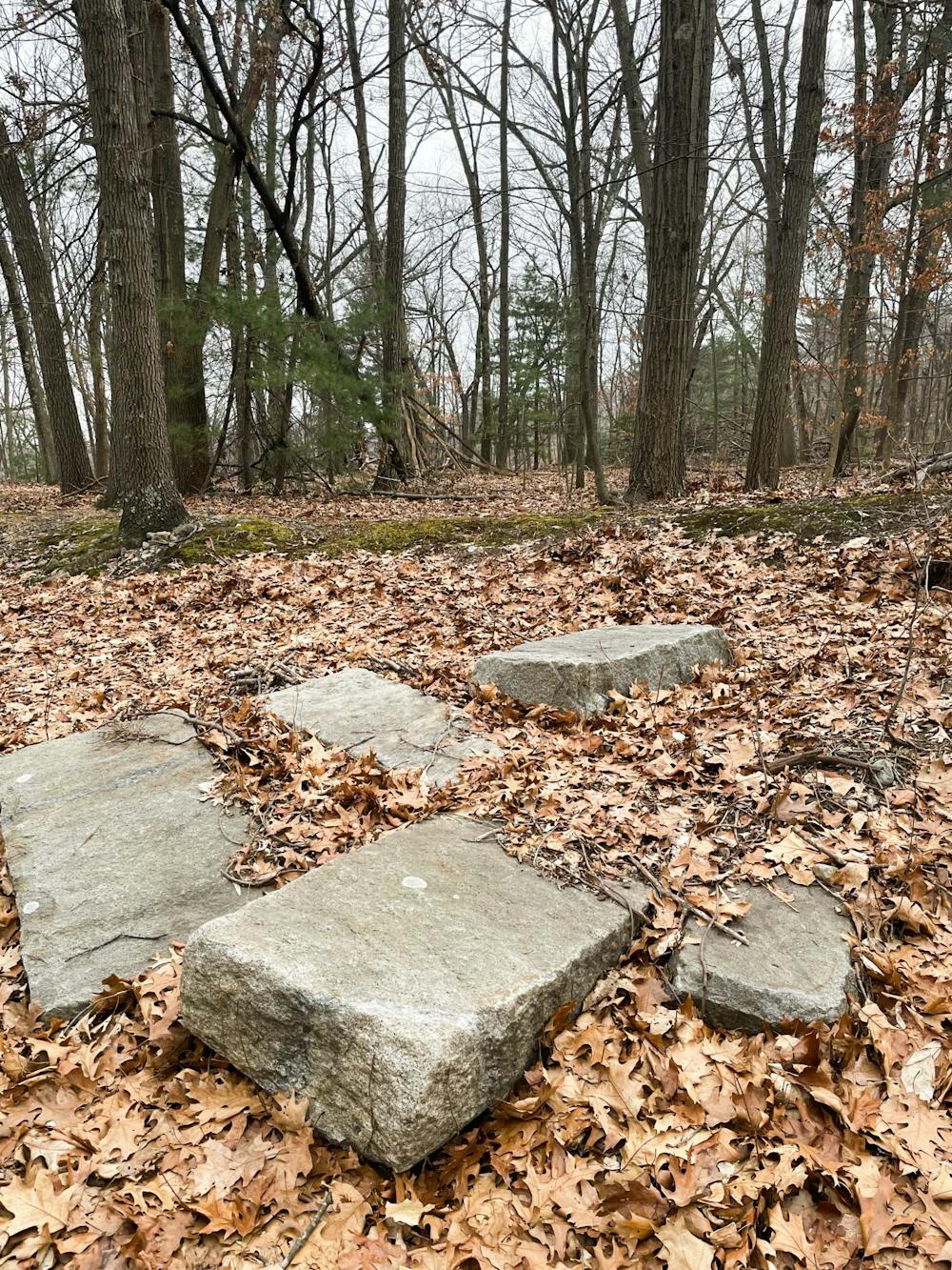
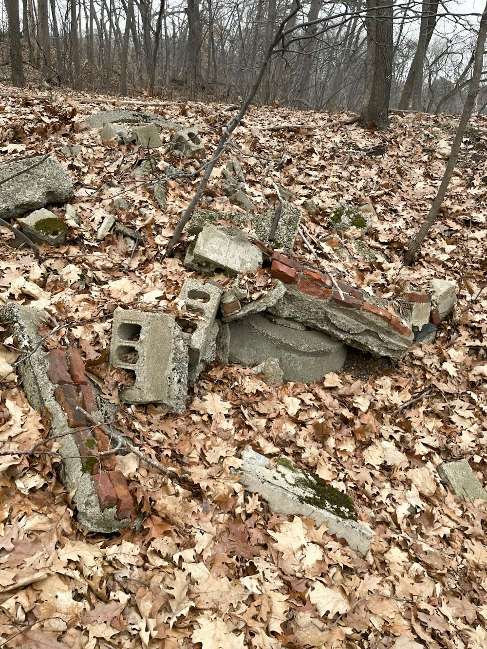
While what Nissen heard remains to be explained, the mysteries within the woods don’t stop there. Upon entering the woods from the parking lot, a pile of ruins can be found on the right side of the trail. Bricks and cement are half-buried under dirt and leaves in the side of a slight hill, old and weathered. The stone slabs, bench-sized, are worn too, as is the strange circular object nearby. What is it all? And why is it there? After weeks of wondering, I decided it was worth an investigation.
I couldn’t deduce much from the ruins alone, so I started the search for answers at the Brandeis Archives. However, Fox Park is public property and not under Brandeis jurisdiction, so I wasn’t able to find much. No leads were found in the University library either. I tried the Waltham Historical Society next, but they could not be reached for comment.
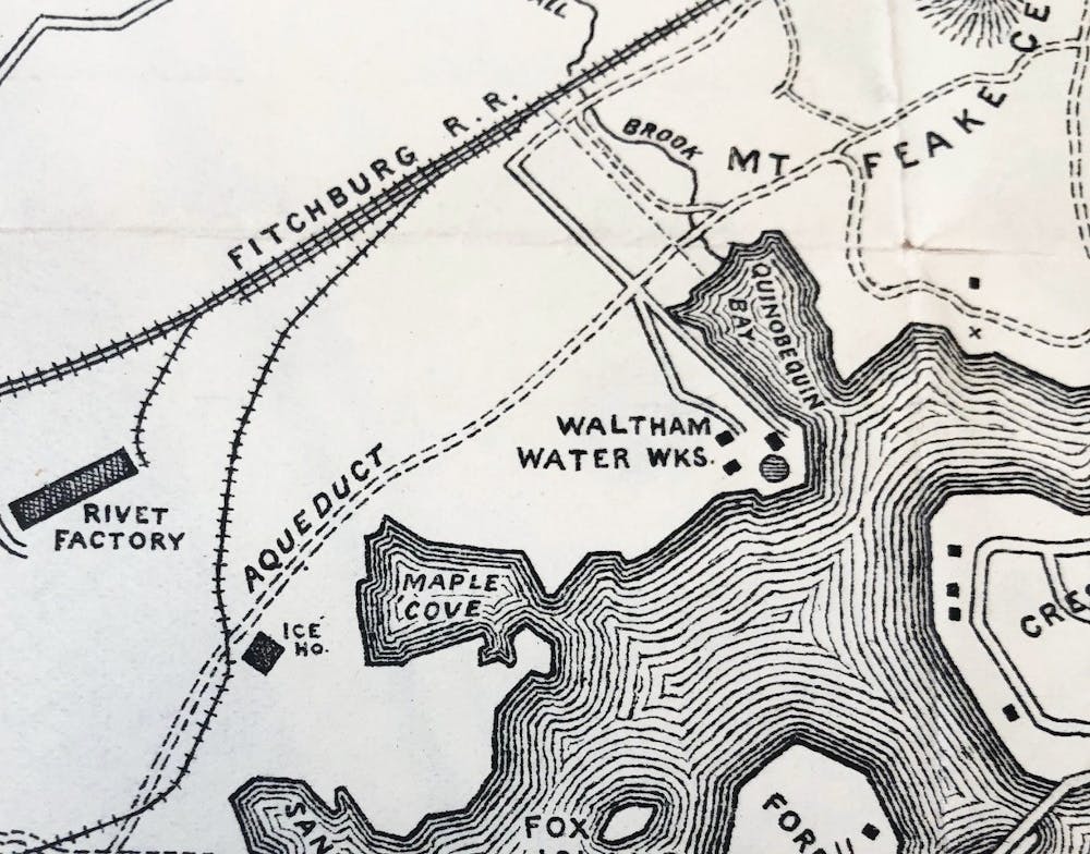
It seemed I’d hit a dead end. Fortunately, Dana Hamlin, an archivist at the Waltham Public Library, came to the rescue. “The one named structure on that peninsula that I've been able to find on old maps is an ice house,” Hamlin said in a Feb. 16 email correspondence. The ice house, drawn towards the bottom left corner of the map she found, is marked to be in the exact spot where the ruins appear in the woods.
Ice houses were extremely popular prior to the invention of the refrigerator. They were used to keep ice cool year-round or to store perishables. New England, historically, was a hub for ice harvesting, and ice shipment lines ran from around the Boston area to the southern United States until the popularization of the refrigerator in the 1920s.
Hamlin was also able to find a potential visual on the area around the ice house in Fox Park. “A contact at the Waltham Historical Society found this photo of people harvesting ice on the Charles circa 1890,” Hamlin wrote in an email on Feb. 26. “They think it's near Fox Park, as there's a cemetery in the background (most likely Mt. Feake) and the ice house was still in use at that point.”
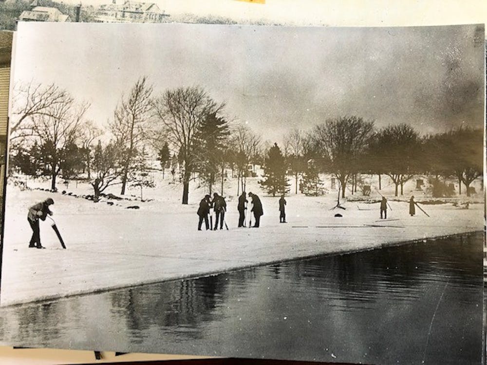
While Hamlin detailed that it wasn’t clear if the marked Fox Park ice house was used by a private residence for personal storage or by a larger company, it’s likely that the ruins behind the Charles River quad are what remains of it: a wintery tombstone for a dead trade.
The mystery of the ruins — and its consequent solving — was a wonderful reminder of what might be hiding in plain sight for students. And for Hamlin, puzzles like these are always enjoyable. “I love when I can help solve mysteries,” she wrote. “It’s the best part of my job.”

Please note All comments are eligible for publication in The Justice.